Drone Surveys
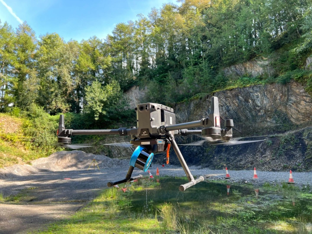
JWES Surveys is a premier provider of aerial and land surveying services using cutting-edge drone technology to deliver centimetre-level precision. Our industry-approved GNSS equipment ensures the highest reliability and accuracy of data. We pride ourselves on offering cost-effective, professional services that drive project success.
Safety is our priority, with all flights conducted under Civil Aviation Authority approval and backed by commercial insurance. Our extensive industry knowledge and commitment to excellence make us a trusted partner for your surveying needs.
Our drone services our offered throughout Havering and Bromley and their surrounding areas.
Our Services
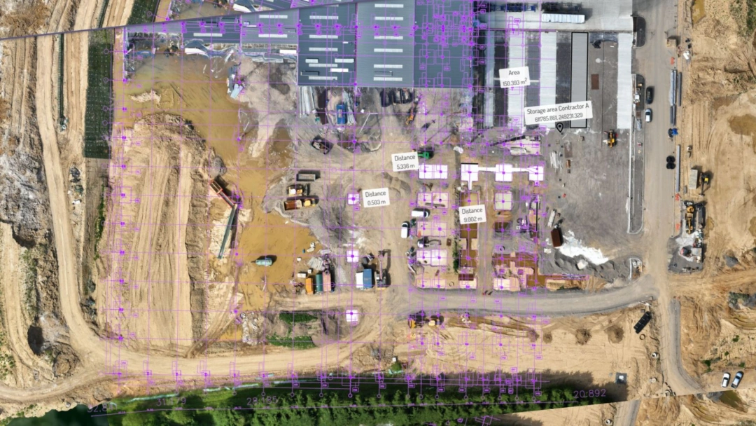
Drone Surveys
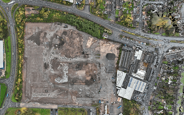
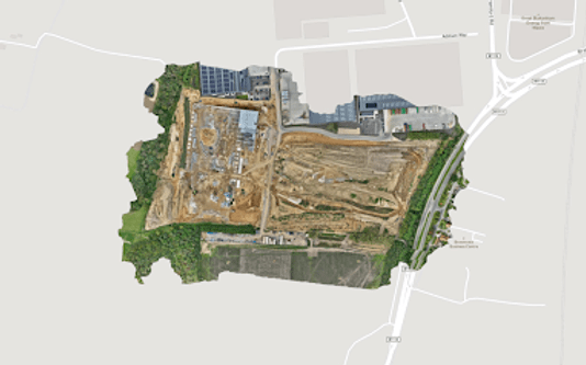
Aerial Surveys
Land Surveys
Construction Management Surveys
Property and Land Photography
High-resolution Inspections
Live Event Coverage
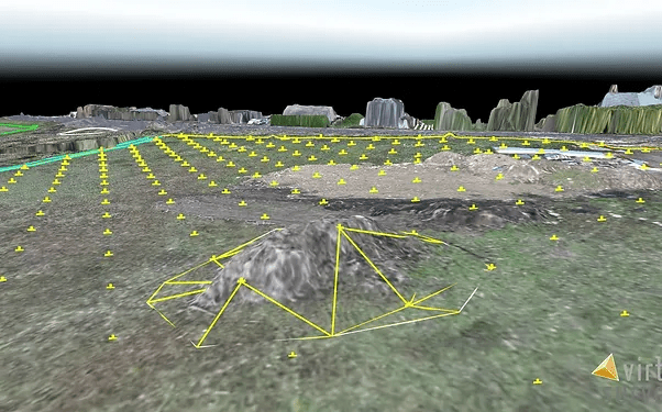
3d Mapping
Modelling and Visualisations
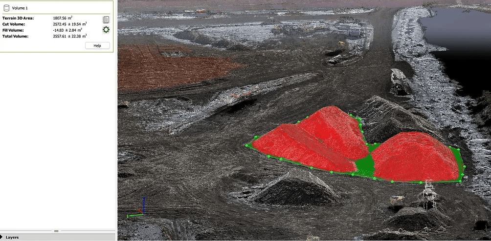
Stockpile Management
Stockpile Management
And More...
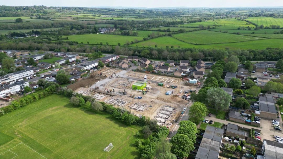
JWES Surveys offers a vast range of drone services to meet the needs of businesses. We specialise in aerial surveys, providing high-precision data for construction management, inspections, and stockpile management. Our advanced drone technology enables us to deliver real-time updates and progress reports, ensuring that your project stays on track.
We also provide 3D mapping, modelling, and visualisations to bring your projects to life. Our high-resolution photography and videography services enhance property listings and event coverage, giving you a unique and professional perspective.
These are just some of the many drone services our business offers. Get in touch with us today to learn more.
Opening Times
| Monday | 08:00 - 20:00 |
| Tuesday | 08:00 - 20:00 |
| Wednesday | 08:00 - 20:00 |
| Thursday | 08:00 - 20:00 |
| Friday | 08:00 - 20:00 |
| Saturday | 08:00 - 14:00 |
| Sunday | Closed |
| - | - |
Gallery
Customer Reviews
0 Reviews